Agia Kyriaki Mega Project · Sithonia · Halkidiki · Greece
Four hundred hectares of Aegean coast.One owner. One transaction.
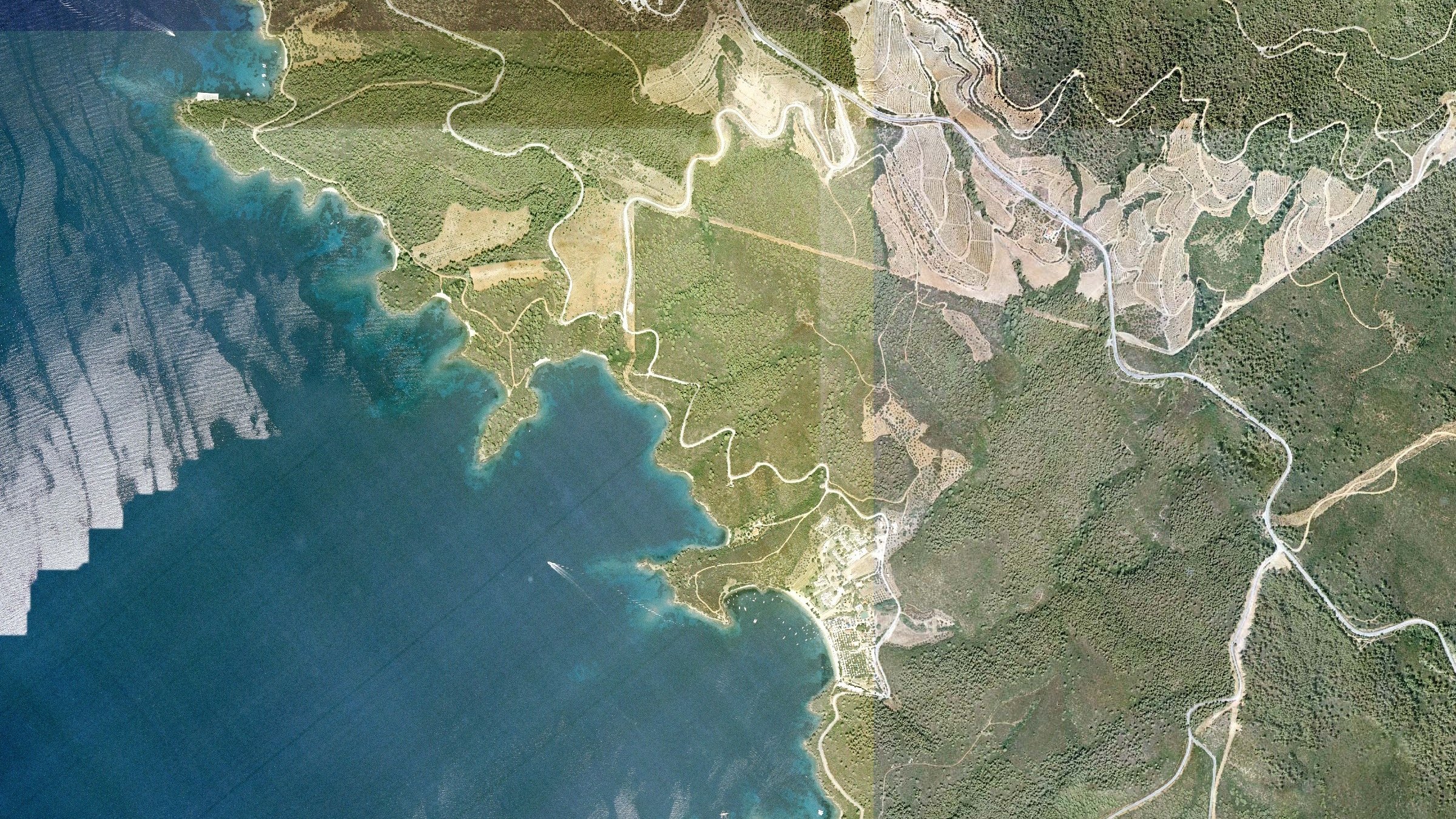
A contiguous 4,343-stremma estate on the Sithonia peninsula, adjoining Porto Carras, with more than 1.6 km of private shoreline, clean cadastral title and building rights for a resort destination of international scale.
≈ 434 ha · 1,073 acres
Total surveyed area, Jan 2026
private coastline
Shoreline & beach line gazetted
buildable above ground
+ equal basement area
clean cadastral title
Three S.A. companies · one owner
The opportunity
A single-owner coastal domain beside Porto Carras
Municipality
Sithonia, Halkidiki
Community
Neos Marmaras
Planning
Within the General Urban Plan
Permitted use
Tourist & sports facilities
Ownership
3 S.A. companies · 1 owner
Title
Clean · cadastre-registered
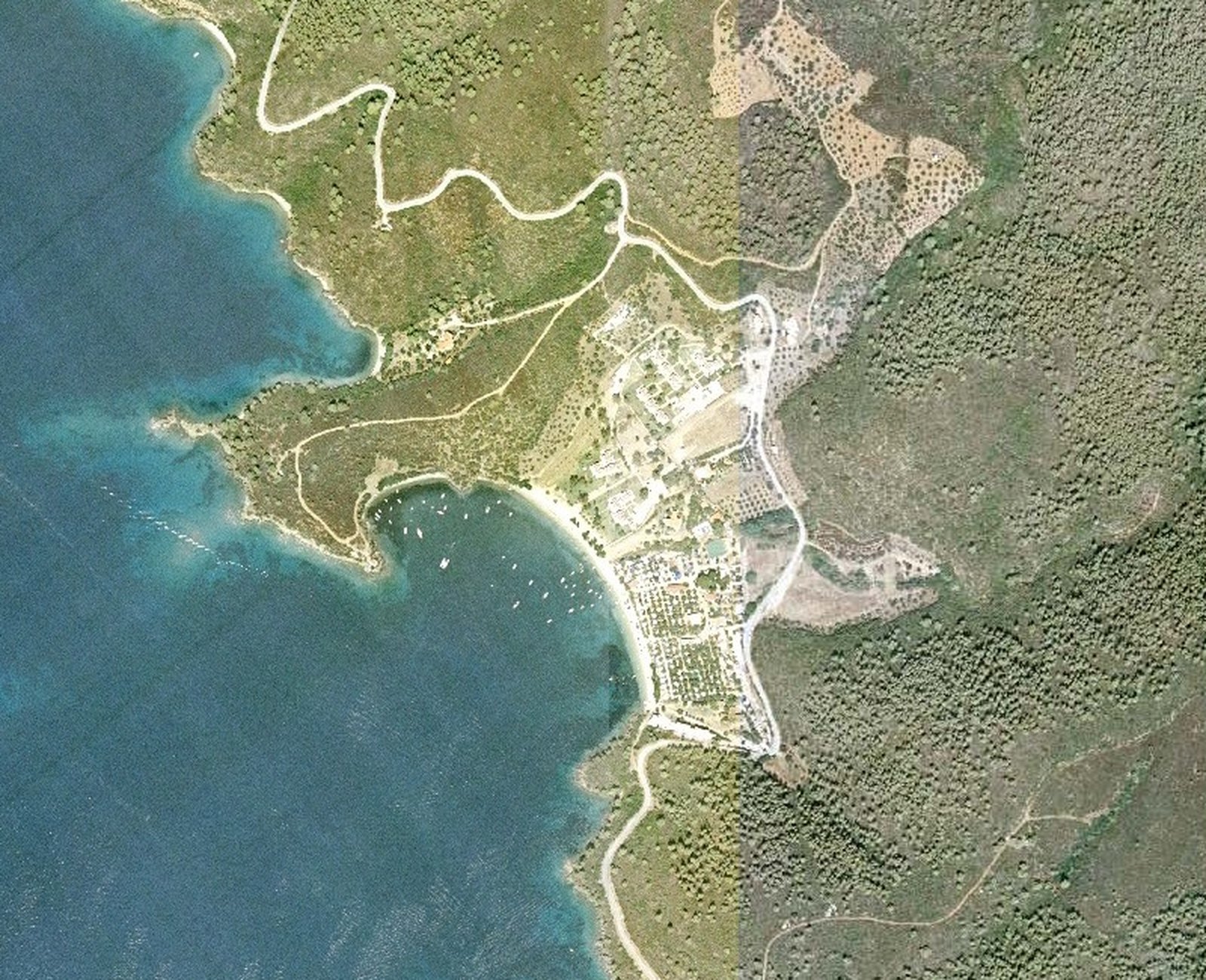
Agia Kyriaki is a contiguous estate of roughly 434 hectares on the west coast of the Sithonia peninsula, Halkidiki, in the Municipality of Sithonia (community of Neos Marmaras). Pine-covered hills descend to a sheltered bay with more than 1.6 kilometres of shoreline, in one of the most established resort regions of northern Greece.
The land adjoins the celebrated Porto Carras resort to the west and is served by existing road, power, telecom and water networks. The entire estate lies within the General Urban Plan of the Municipality of Sithonia, is designated for tourist and sports facilities, and is held through three Greek sociétés anonymes owned by one family.
Title is clean and cadastrally registered, free of mortgages, liens and claims, with no open matters before the Polygyros forestry or antiquities authorities. Development is intended under Greece’s Strategic Investments framework, which allows building density to be increased and the shore and beach to be conceded for use.
Clean on every front
No debts. No forestry issues. No antiquities issues.
No financial encumbrances
Neither the land nor the three holding companies carry any mortgage, lien, pre-notation or debt. Certified by legal search of the Sykia land registry and the cadastral office.
No issues with the Polygyros Forestry Service
No pending forestry claims, disputes or infringement proceedings. The forest character of the land is settled by the 1982 characterisation act and the 2026 cadastral survey.
No issues with the Polygyros Ephorate of Antiquities
No archaeological restrictions or open matters. The Archaeological Service already permitted a tourist complex on the estate in 1976.
Location
The middle leg of Halkidiki, facing the sunset
Sithonia is the quietest of Halkidiki’s three peninsulas: pine forest to the water’s edge, turquoise coves and a single ring road. The estate sits on its western shore, looking across the Toroneos Gulf toward Kassandra, with Porto Carras and the town of Neos Marmaras immediately to the north.
Adjoining
Porto Carras resort & marina
shared western boundary
≈ 8 km
Neos Marmaras
town, harbour, services
54 km
Polygyros
prefectural capital
≈ 120 km
Thessaloniki International Airport
about 1 h 45 by road
≈ 82 km
Mount Athos
UNESCO World Heritage site
The land
4,343 stremmata, surveyed on cadastral boundaries
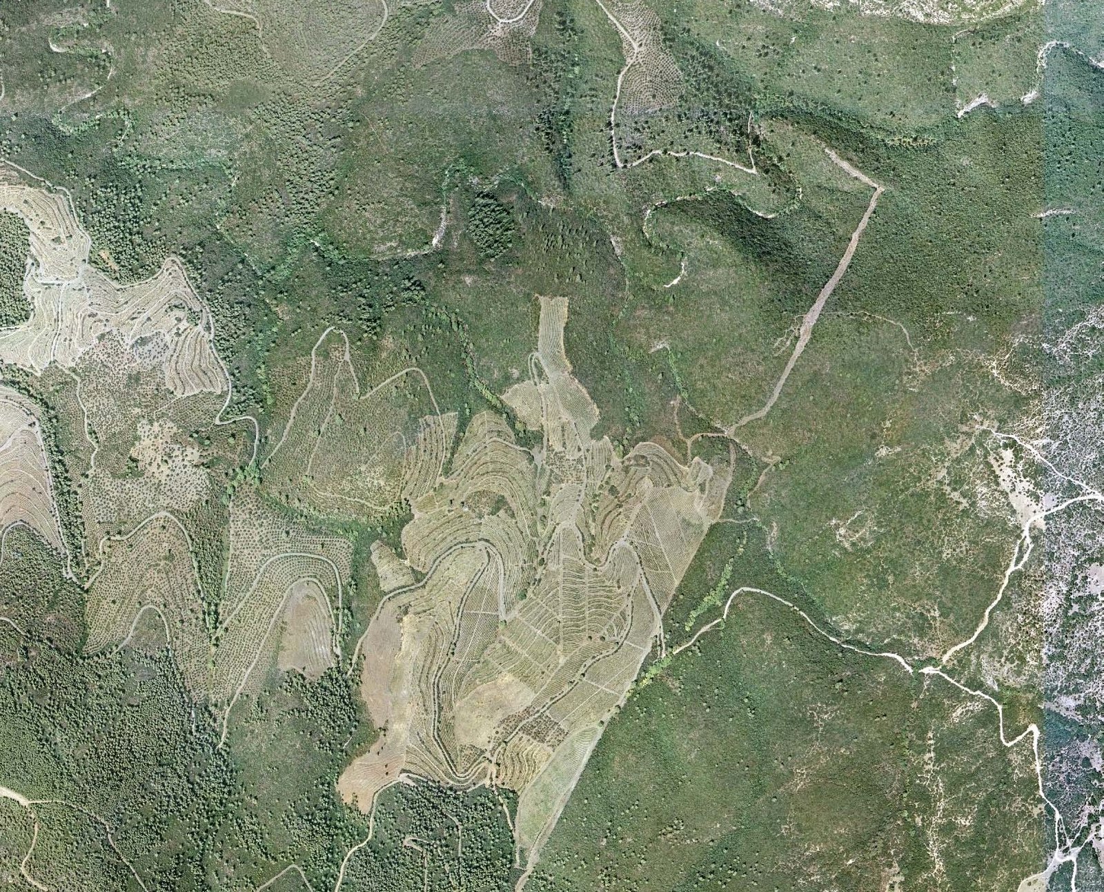
The January 2026 topographic plan maps every National Cadastre parcel of the estate onto the aerial survey. Forest land makes up 98% of the area; three small groups of parcels are formally agricultural. The whole is designated for tourist and sports facilities.

Legend
Ownership
Three sociétés anonymes, one family, one contiguous holding.
Chalkidiki S.A.
Chalkidiki S.A. — Agricultural, Tourist, Mining & Commercial-Industrial Enterprises
3,699.4str.
G. Panagakis S.A.
Hotel, Tourist, Commercial & Industrial Enterprises G. Panagakis S.A.
375.5str.
Tourist Coasts of Sithonia S.A.
Tourist Coasts of Sithonia–Halkidiki S.A.
268.1str.
Composition
- Forest & forest land4,260.4 str.
98.1% of total
- Agricultural land82.7 str.
1.9% of total
Three groups of parcels totalling 82.7 stremmata (68.3, 13.5 and 0.9) are formally characterised as agricultural land; the remainder is forest land.
4,343.1
stremmata
434.3
hectares
1,073
acres
Planning status
- Outside the town plan — Presidential Decree of 24 May 1985 (Gov. Gazette 270/D/1985), as amended by Gov. Gazette 308/A/2003
- Outside settlement zone
- Within the General Urban Plan of the Municipality of Sithonia
- Whole and buildable
Permitted land use
Tourist and sports facilities may be erected
As stated on the 2026 topographic plan
Development potential
Room for a resort destination of international scale
The owner’s development brief states building rights of 243,900 m² of above-ground floor area plus an equal basement area. The legal basis is Law 998/79 (art. 49, as amended by Law 4685/2020), under which up to 10% of private forest land may be released for tourism with a building coefficient of 0.5 on that footprint. Under the Strategic Investments framework (ESHASE) density can be increased further, ancillary works are not counted, and the gazetted shore and beach can be conceded to the operator without auction.
Statutory threshold
4,343
stremmata · Agia Kyriaki
500
stremmata · legal minimum
Law 998/79 art. 49 §4b requires a minimum of 500 stremmata of private forest land for composite tourist accommodation and special tourist infrastructure. Agia Kyriaki is nearly nine times that size, comfortably within the 0.5 coefficient band that applies up to 5,000 stremmata.
Expressly permitted by Law 998/79, art. 49
- 4- and 5-star hotels
- Composite tourist accommodation (hotel + villas)
- Golf courses
- Thalassotherapy centres
- Spa & hydrotherapy centres
- Special tourist infrastructure
- Cable cars, gondolas & lifts
- Ski centres
Article 49 as amended by art. 102 §3 of Law 4685/2020. Coverage limited to 10% of the area approved for tourism; building coefficient 0.5 on that 10% for estates up to 5,000 stremmata.
4- and 5-star hotels
Primary hotel accommodation on the bay and the pine terraces above it.
600–700 villas
Complex tourist accommodation: 30–40% of the coefficient (73,000–98,000 m²) as residences for sale or long lease.
Private marina
A sheltered bay with a gazetted shoreline suited to a yacht marina and beach club.
Golf & sports
Golf course, sports academies, camps and equestrian facilities across the interior valleys.
Conference & culture
Conference centre, film studios, theme park and thalassotherapy.
Retail & dining
Restaurants, cafés and shops serving the resort, the marina and the beach.
Building rights
- Above-ground floor area (owner’s brief)
- 243,900 m²
- Basement area
- 243,900 m²
- Coverage (release of forest land)
- up to 10%
- Building coefficient on released land
- 0.5
- Residences within complex accommodation
- 30–40% of coefficient
- Rooftop photovoltaics
- Permitted
Per Law 998/79 art. 49 as amended by Law 4685/2020 and the owner’s development brief. Subject to the Strategic Investment approval process.
Regulatory framework
- Strategic Investments Law (ESHASE)
- Fast-track licensing; density may be increased; shore & beach concession
- Law 998/79, art. 49
- Private forest land may be used for tourism under the same terms as public forest land (para. 4a), and for composite tourist accommodation and special tourist infrastructure (para. 4b)
- Shoreline & beach
- Already determined by Government Gazette
- Utilities
- Power, telecom and water networks present in the area
Shore & beach
Beach management
- Frontage
- More than 1,600 m of shoreline lies within the estate; the beach can be landscaped and redeveloped within the legal framework.
- Status
- The beach zone has been paid for by the owner. The new owner operates it in cooperation with the Greek State and the Public Properties Company (ETAD).
- Concession
- Simple-use concession of shore and beach is granted without auction to businesses operating lawfully on adjacent land.
- Eligible operators
- Main hotel accommodation · furnished rooms and apartments · food and beverage establishments · organised campsites.
Provenance
Six and a half centuries of unbroken title
The neighbouring Porto Carras resort was created in the 1960s–70s by shipowner John Carras on land that once formed part of the same monastic holding. Agia Kyriaki is the remaining, undeveloped part.
- 1357
Imperial chrysobull
Byzantine Emperor John V Palaiologos grants the land to the Holy Monastery of Esphigmenou on Mount Athos.
- 1965
Acquisition from the monastery
The estate is purchased from Esphigmenou Monastery by notarial deeds in Nafplio, Athens and Sykia; the Greek State waives its right of pre-emption (Ministry of Agriculture decision 36491/270, 1965).
- 1963–76
First approvals
Subdivision permits (1963, 1973), a campsite licence from the Greek Tourism Organisation (1973) and an Archaeological Service permit for a tourist complex (1976).
- 1973–75
Corporate structure
The land is contributed into three sociétés anonymes that have held it, with no other activity, ever since.
- 1985 · 2003
Planning framework
The Presidential Decree of 24 May 1985 sets the out-of-plan regime; the General Urban Plan of Sithonia designates the estate for tourist and sports facilities.
- 2012
Legal certification
A Thessaloniki law office certifies 4,343,100.85 m² across 24 cadastral parcels, free of any mortgage, lien or claim, with an assessed objective value of approximately €240–250 million.
- 2026
Updated survey
A new topographic plan on National Cadastre boundaries confirms 4,343.1 stremmata and the split between the three companies.
The transaction
One transaction. Three companies. The whole coast.
Offered as
100% of the shares
of the three holding companies, in a single transaction. Terms on request.
3
S.A. companies
24
Cadastral parcels
0
Encumbrances
- Structure
- Share sale. The estate is transferred by transferring the shares of the three S.A. companies, which hold no other assets or activities.
- Encumbrances
- None. The land and the companies carry no mortgages, liens, pre-notations or financial burdens.
- Authorities
- No pending matters with the Polygyros Forestry Service or the Ephorate of Antiquities.
- Assessed value
- Objective (tax) value certified in 2012 at approximately €240–250 million.
- Third-party enclaves
- A former campsite under 40,000 m², a villa and a house are excluded from the area sold and may be negotiated separately.
- Process
- On presentation of proof of funds, the seller delivers the full document set with a legal letter from a major law firm confirming the authenticity of all signatures.
Data room
Documentation available under NDA
Title & cadastre
- Notarial deeds of acquisition (1965) with certified translations
- Contribution deeds to the three companies (1973–75)
- National Cadastre (KAEK) extracts for all 24 parcels
- Legal certification of clean title (2012)
Surveys & planning
- Topographic plan on cadastral boundaries (January 2026)
- General Urban Plan study — Municipality of Sithonia
- Shoreline & beach determination (Government Gazette)
- Forestry Service characterisation acts and correspondence
Corporate & tax
- Articles of association and Gazette filings for each S.A.
- Balance sheets and tax-clearance certificates
- Property-tax declarations
- Business registry (GEMI) certificates
Valuation
- Objective-value determination (Polygyros tax office)
- Forest estate report and development brief
- Satellite imagery and aerial survey
On the ground
See the bay and the pine hills
Agia Kyriaki, Neos Marmaras — aerial and ground footage (June 2019)

Contact
Request the data room
Qualified investors and their advisers may request the full documentation, arrange a site visit, or discuss the transaction structure directly with the appointed broker.